The hike began at the Copper Creek Trailhead at the end of Highway 180 near Cedar Grove. After gaining 5,000 feet elevation, I left the trail at the crossing to Granite Basin, and headed cross country to Grouse Lake. Skies were hazy from nearby forest fires. After a soup break at the lake, I hiked over Grouse Lake Pass and through the eastern reaches of Granite Basin.

Grouse Lake Pass from Grouse Lake - The first and one of the easiest passes on the route is Grouse Lake Pass. It is a simple hike from either direction.
Goat Crest Saddle
Goat Crest Saddle from Glacier Valley - The approach to Goat Crest Saddle from the south is up a grassy slope. The north side, shown above, is steeper but it is not difficult.
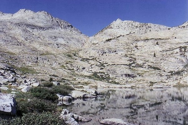
took me to the uppermost lake in Glacier Valley where I spent the night.
Looking North from the Uppermost Lake in Glacier Valley - There are fine camp sites at the mouth of this lake. I never dreamed I would make it here on my first day.
Day two dawned with a sky full of crystal clear air. A wind storm in the early morning cleared the skies of smoke from the nearby fires. After a quick hop down the valley, I followed the State Lakes Trail through the State Lakes Basin and hiked on to the Horseshoe Lakes Basin. At the northern Horseshoe lake, I left the trail and traveled cross country over Windy Ridge, Gray Pass,

Gray Pass - From the Windy Ridge side, Gray Pass does not look like much. From the South Fork of Cartridge Creek, however, it looks like a real pass (see above).
White Pass,

North Side of White Pass - From the south, White Pass is an easy climb up gravelly talus. From the North side, however, it is steep and rocky. Some of the switchbacks built by the Sierra Club remain intact.
and Red Pass

East Side of Red Pass - Trail is visible on the steep, east side of Red Pass. The west side is a gentle grassy slope.
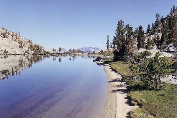
to a campsite near Marion Lake.

Marion Lake from the West - The setting for Marion Lake is truly spectacular. The lake is surrounded by rock of varying color and texture. Forest fringes its banks, its trees framing the marvelous views.
On the third day, I hiked across Lake Basin then made it over snow-filled Dumbbell Lakes Pass
Dumbbell Lakes Pass from the South - Dumbbell Lakes Pass was filled with snow which made the going slow. Storm clouds threatened but never produced.
and into the remote and lovely Dumbbell Lakes Basin.

Dumbbell Lakes Basin is at tree line and has a scoured look. I did not see signs of another soul in the basin even though there were lots of tracks leading up to Cataract Creek Pass. In addition to footprints, I spotted cougar tracks.
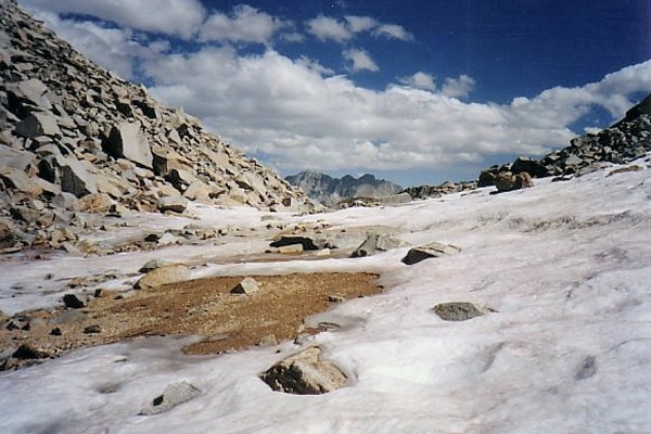
A downpour threatened, but all I got was sprinkles. I made my way over Cataract Creek Pass, the last and most difficult cross country pass of the trip.

Cataract Creek Pass from Amphiteater Lake - A huge cornice choked the low point of the pass, but the slight detour to the north did not slow me down much. The Dumbbell Basin side of the pass was a stroll.
The north side of the pass was choked with snow which made the hike down time consuming. I made camp at Deer Meadow on the John Muir Trail.
I spent three leisurely days completing the loop, returning via Mather Pass, Pinchot Pass, and the Woods Creek Trail.
One Page Version 30 January 2013