Sunset at Disappointment Lake - Not a bad ending to an afternoon that was filled with a soaking rain storm.
I slept warm and well in my new tent that night and awoke to a crystal clear morning in which the coyotes in the upper part of the basin yelped their joy for life. I looked back toward Disappointment Lake and realized it had already started to cloud up.

Disappointment Lake - This is what I saw as I took a last look back toward the lake on my way up to the Hell for Sure.
However, views remained spectacular for the remainder of the day. The walk up to Hell-for-Sure Pass was not difficult, despite the name.

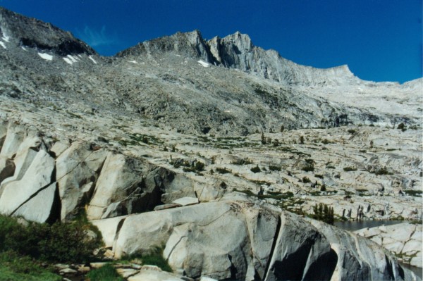
Hell for Sure Pass from just above Hell for Sure Lake - From the west, as can be seen from this photo, it certainly is not hell. From the east, I can imagine that early travellers found the name totally appropriate. Since then, newly engineered trail has reduced it from hell to heck
I saw some fish in Hell-for-Sure Lake which I had thought was barren because of its high elevation.

Hell for Sure Lake from Hell for Sure Pass - No lake is so misnamed as this one. Not only is it beautiful, it even has fish in it.
From the top of the pass, I spotted a large group hikers at the lake.
The trip into Goddard Canyon was relaxing and filled with beauty.

Outcrop encircled by mountain heather - Beautiful outcrops like these are found just east of Hell for Sure Pass. The heather surrounding this outcrop was in full bloom. The moon was peeking over the outcrop but it can't be seen in this scan.
Many gardens of wild flowers were in full bloom and I stopped to take photos several times.

Flower Garden below Hell for Sure Pass - Next to the creek that cascades down the slopes from Hell for Sure Pass are numerous flower gardens containing a great variety of wild flowers.
The group I spotted from the pass, 11 high schoolers and two leaders, caught up with me while I was taking my first lunch break.
The trip up Goddard Canyon took longer than I thought it would. Martha Lake and Reinstein Pass finally came into view at 1:40.

Reinstein Pass from Martha Lake - When I arrived at Martha Lake, the next obstacle, Reinstein Pass, lay before me on the ridge beyond. The pass is uncomplicated but I remember it as a fair workout.
After another lunch break, I headed around the east side of the lake toward Reinstein Pass which leads into Goddard Creek drainage. Another group of Outward Bounders were setting up camp on the west flank of Mount Goddard in preparation for an early ascent the next morning. Reinstein Pass seemed easier than it had been the last time and I reached the top at 4. Cloud cover was heavy again as I looked back toward Martha Lake.

Martha Lake from the South - By the time I reached the pass into Goddard Creek Canyon, the view down Goddard Canyon was filled with clouds.
The descent into the valley was steep but uneventful.

Goddard Creek Valley from Reinstein Pass - This valley always conveys a great sense of remoteness to me when I enter it. Maybe that's because I've only seen one party in it the several times I've been there.
Ribbons of water cascade into the upper reaches of the Goddard Creek Valley from the Ionian Basin.

Reinstein Pass from the South - This is one of the most memorable views in the area-the rugged red cliffs below Reinstein Pass and above Lake10,212. Delicate ribbons of water jump over the cliffs as they flow into the valley from the Ionian Basin.
I started setting up camp on Lake 10,212 at 6:30. 1 was surprised to see fish in the lake since I had not seen any the last time I had been through here. I caught 8 or 10 hybrids and kept the three largest which I ate for dinner. Almost everything had dried out from the day before and only a few drops of rain fell on this day. The sunset was particularly beautiful.

Another beautiful sunset, this one above the White Divide from Lake 10,212.
The next day, I stayed above the creek on the west flank of the valley. There were two tents near the creek and above the lakes below Lake 10,212. I was disappointed to see the tents but their occupants never knew I passed by. The lakes on the western branch of Goddard Creek offer numerous camping spots although I saw no fish in the lakes.

West Fork of Goddard Creek - This basin looks like a sought after destination. So far it has only been an area to pass through on the way to somewhere else.
The ascent to Blue Canyon Pass was easy enough.

Blue Canyon Pass - In the center is Finger Peak, flanked on the left by Blue Canyon Pass, the entrance to Blue Canyon and on the right by Finger col, the way into Blackcap Basin.
I decided against a trip down into Blue Canyon in favor of climbing Finger Peak.

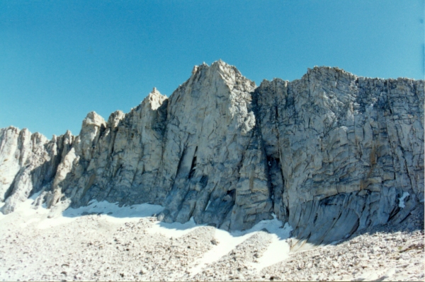
Finger Peak from the North - Finger Peak sure looks imposing from this direction. It is an easy climb from the other side. A dozen of us made it up the day I climbed it. The views from the top are comparable to those from Mount Goddard.
The climb was not difficult as long as I stayed away from the steep jagged rocks that make up a good part of the east flank of the mountain. The view from the crest rivals the view from Mount Goddard. I was surprised from reading the register that I was about the tenth visitor to the top that day. I saw no one else on the mountain until I met a guy heading up as I was almost back to the pass. As I descended back into the West Fork drainage, I noticed Finger Col which would provide entrance into Blackcap Basin.

Finger Col from the East - Another particularly beautiful part of the trip passes through the west fork of Goddard Creek. The intense dark blue of the interconnected pools contrasts with the white granite outcrops and bright green fringing grass.
By 3:45 1 reached the pass into Blackcap Basin. Yet another Outward Bound group could be spotted above Cathedral Lake, so I headed to the smaller, nearby Chapel Lake to try to find some solitude.

Cathedral Lake from Finger Col - The lakes of Blackcap Basin are some of the lovliest in the range. Not only that, but many of them are filled with fat trout.
I had Chapel Lake all to myself and the fishing was great to boot. My camp site had a great view of Finger Peak and there was enough wind to keep the mosquitoes down.

Finger Peak in Alpenglow - Another beautiful end to the day as the white granite became tinted with shades of pink and gold. Finger Col is the dark notch on the ridge and to the left of distant Finger Peak.
I discovered that I had "taken" 36 photos with an empty camera. I sure was glad I had brought two cameras but I was disappointed about "losing" some of the photos, especially ones from the crest of Finger Peak.
The return to Courtright on the last day was long, 28 miles in about 11 hours. I saw a lot of people on the way back and visited with some backpackers for half an hour. They were in their 60's and had hiked all over the Sierra Nevada Range. Another group, on horseback, had suffered a major mishap on the Bench Valley trail. The trail had given away beneath one of the horses and its rider had been seriously injured when the horse rolled on him. The Bench Valley trail is posted as unfit for stock.