Day 1
7/17/90 Tuesday10:20am Sawtooth Ps Tr
First crk xing. On trail at 9:40 after a long trip up Mineral King road. Ranger station opens at 7 am. Cloudy day. Beautiful country.
2:15 Sawtooth Ps

Walked up from Monarch Lk with a German couple for part of the way. Lots of clouds, may rain.
4:30 Hands and Knees Pass

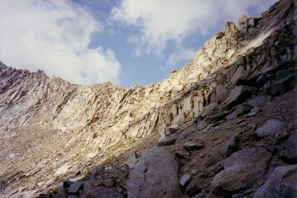
It was slow going but not dangerous getting here. The trail is ducked from Columbine to above Cyclamen and then pretty obvious after that.

It does not look like it will hard to get down into Big Five Lake Basin.

It is very hazy today but I haven't been rained on. Thunder clouds are all over but it has thundered only far to the east. A fearless marmot guards the pass.

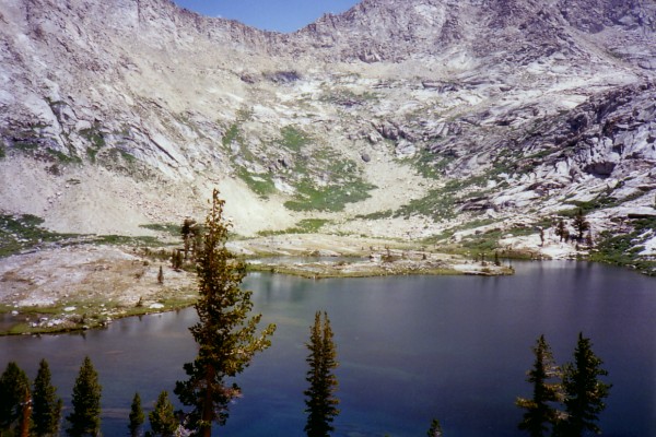
6:30 Uppermost of Big Five Lakes
Got here about 6. Dinner is almost ready. I feel tired. Both passes were difficult, i.e., steep. There are others up here. I've heard their voices but haven't seen. Big thunder cloud in east is slowly moving this way but it is mostly clear to the west.

This is a pretty spot. I would come here again. I'd forgotten how wonderful it is to start in Mineral King. The gorgeous scenery at the beginning of the hike makes the difficult drive worthwhile.
Day 2
7/18/90 Wednesday7:20 Uppermost Big Five Lake

Awake at 6 up at 6:20. 40 degrees at 6. Warm. Clear this morning but haze now forming to east. Slept well. The waterfalls are quieter in the morning because not as much melting is taking place. I need to put this journal away after this trip is finished. I'd hate to lose it. Today I'll explore both 5 Lk Basins, maybe do a little fishing, and relax. If I get too bored, maybe I'll hike over Black Rock Ps to Spring Lk.
9am Largest Big 5 Lk
It's very peaceful and quiet here. Heard a coyote call 15 minutes ago. Found some onions for soup. Fish are feeding on the lake. Small Brooks in this lake and the one above. Excellent developed camp in bay on N side of large lk.

Sounds like someone is blasting for trails. It must be distant thunder since it has been going for several minutes.
11:30 Little Five Lk Basin
It has been lightly sprinkling on and off for the last hour or so. Met a retired engineer from Orange Co as I started up from Big 5. We (mostly he) talked for 20 or 30 minutes abt hiking experiences. He climbed Kaweah Queen this week.
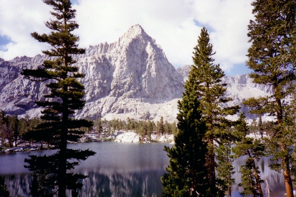
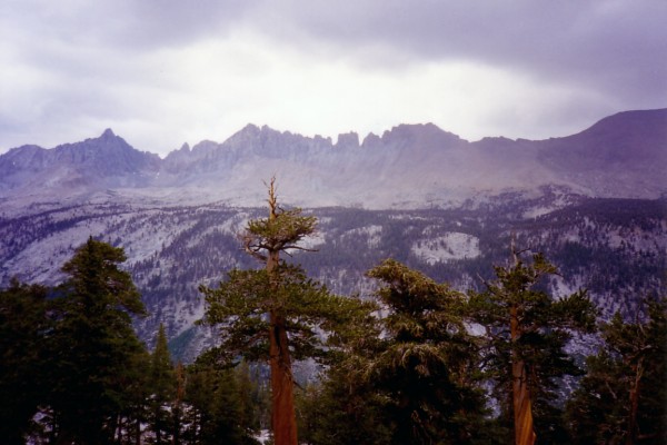
12:30 Little 5 Lks are distributed among two basins. I'm between the two drinking in a grand view of the Kaweah Peaks Ridge (KPR), Triple Divide Pk and others.
 Saw a bear at the lake where the trails meet.

[The next section of the journal was written in Haiku.]
Sierran Storm
During the sprinkling
The waterfall ignores the drops
Crashing as always
Thunder from the clouds
Rumbles and grumbles overhead
I'm snug under trees
Kaweah Peaks Ridge
Shrouded in part by the rain
Still looks beautiful

Sitting in the rain
I could be very depressed
Instead I write verse
The storm is gentle
I watch it with interest
Will it get much worse?

The rain falls harder
The ridge is dissolved by mist
Will it be gone long?

Huddled under trees
This hiker shivvers and asks
When will the rain stop?
As the storm passes
The ridge reappears unchanged
As if by magic.
Is it clearing now?
The sky is getting brighter
But still there's no blue
During storms like this
Mosquitos must hide somewhere
They aren't biting now

Sitting on a rock
I wonder if it will rain
And make the night long
The sky is clearing
Was there really a rainstorm
Or was I dreaming?
4:45 Uppermost Little 5 Lk
Sitting through and walking in this storm has been much more pleasant than I ever could have imagined. A little blue sky appears now and then. It hasn't sprinkled for half an hour. As I write that, it begins again. This is a serene spot with a great view of the KPR. I saw forked-horned buck on the way up here. I think I've seen and heard more wildlife on this trip than any other; deer, bear, grouse, coyote, marmots, squirrels, pikas, and many kinds of small birds. This is a premier route. The lake is murky with green algae. I wonder if there are fish in it?

5:45 The sky is partly cloudy now. I'm almost out of film. What a shame!
Day 3
7/19/90 ThursdayUp a little before 6. It's now 6:15 and the sun just came up over Red Spur. This morning's temp 40 degrees. Slept cooler last night because of slight breeze and dampness. I cannot see a single cloud in the sky although it is a little hazy to the east. It appears it will be a stormless day. There were no clouds in the sky last night, either. I came up here in case it might be storming today so I could get out in a hurry. Now I have time on my hands. I could walk N and look down on the large lake 10,410 in Little 5 or get home early.
7:05 I should be on the trail shortly. A helicopter just flew east across Big 5 Lake Basin. Probably a rescue mission.
8:10 Black Rock Pass
Black rx are coarse grained, looks like gabbro or diorite. There are several trails to the top. The new trail is very well built, the old steep. Beautiful view of the crags of Mt Whitney and the KPR. Lakes on Chagoopa Plateau are visible. South basin of Little 5 and largest of Big 5 Lakes also visible. This is not the low point on this ridge. There is a lower saddle at the south end of the black rock outcrop. Glacier Pass looks steep from here. Still no clouds although it is hazy to the east. Crystal clear to west until your eye meets the red valley smog. The metamorphics of the Mineral King Roof Pendant are lovely.
9:10 Arrived at small brook 10 minutes ago. Foot path leads to Spring Lk from here. Still not a cloud in the sky.
9:50 Finishing a food break. Also harvested some pennyroyal. I have a great view of Glacier Pass and the waterfall from Spring Lk.
10:50 Got to Spring Lk at 10:30. Two hikers followed me on well-traveled knapsack trail that leads here from the Black Rock Pass trail. Hands and Knees Pass looks ominous from here. Time for fishing.

12:25 Just finished catching five lovely brook trout. I'm going to take them home for tonight's dinner. I'll try to get some snow to pack them in.
1:50 Just east of Glacier Pass.
Distinct trail most of the way. I'm sitting next to a duck right now. Packed trout in snow. Found pieces of Park entrance sign below the snow field. Clouds are beginning to build but I doubt that it will rain today. Beautiful day. KPR just peeks over the Black Rock Pass ridge. I think I'll have some lunch.
2:10 Decided it made more sense to eat lunch on Glacier Ps, so here I am. There has actually been some kind of trail building here, especially just below the pass going east. An iron bar has been driven to stabilize the trail but it didn't work. Maybe there are others that did because in places the trail is nice. This doesn't remind me of the pass I went over in '72, but now there isn't any snow. Back then, I went down a snow field for a way before hitting rx. It sure looks steep on the east side from Black Rock Pass and anywhere else to the east but it is not a difficult pass.
2:40 Starting down.
3:20 Junction old trail and new just north of Lwr Monarch
I'm going to take the old trail.
4:00 Old prospect pit below cascades on flat. Strong sulfur odor.
5:00 Junction new trail.
Sign at entrance to old trail says, "Trail Not Maintained." It's still in pretty good shape. I lost it only once. I should have started dropping down to go around the cliffs below Empire Mtn, but didn't. Old trail is much more scenic. Passed by an acid rain collection station put up by UCSB. Saw a neat fold in carbonates on south side of the canyon and many waterfalls. Wildlife more abundant, too. Two does and fawn and grouse and chicks. People coming down new trail now. Look like day hikers.
6pm Sawtooth Ps trailhead.
Walked down from junction with couple from Irvine. He's a grad of Exeter high Class of '65. Talked about area and fishing.
6:15 Dropped marmot damage report at ranger station.
