Day 1
The Grant's Grove visitor's center where I was getting my permit didn't open until eight, so I drove down to the grove of big trees to check them out. Part of the trail through the grove was blocked off. A sign said something about the blocked off part of the trail being dangerous because branches could fall on it. Duh! Sadly, a sign of the times. I began the trip at the Marvin Pass Trailhead a little later than I would have liked. A group of packers from Visalia were loading their stock in the trailhead parking lot. I had never seen packers use the Marvin Pass trailhead before. Usually, they start at Horse Corral. The 14 mile trip to Roaring River was uneventful. Views of the Great Western Divide
The northern Great Western Divide from the upper Sugarloaf Creek drainage
and Mount Silliman were clear and the Sugarloaf was as impressive as ever.

Mount Silliman from the same location as the previous photo
My plan was to hike the same 14 mile route from Roaring River out to Marvin Pass on the last day of the trip. I noted that since the trail was mostly down hill that I might want to shorten my last day's hike by coming out to the Sugarloaf. Ranger Cindy Wood was at the Roaring River Ranger Station when I arrived there. We visited briefly until another hiker came over the Roaring River Bridge. I thought to myself, I'd better claim a spot in the campground before they are all taken. I stashed my gear in my favorite place and went to talk to the new arrival. Jim was from Southern California and we found that we had several things in common. Both of us are San Diego State graduates, neither of us has an anterior cruciate ligament in the left knee, and we were both going to go up Deadman Canyon the next morning.
Day 2
After a warm night, the day began with cloudless skies. It looked like a perfect day for hiking. Jim and I would go up Deadman Canyon about a mile beyond the grave marker where we would go our separate ways. He would continue to Upper Ranger Meadow and I would begin crossing Glacier Ridge. Finding the route up was easy enough. Arnot's description was helpful. I began by crossing the river where it flows over broad granite slabs.
The cross country route to the western lakes begins by crossing the creek here.
The way was very steep. Only experienced backpackers with some climbing experience should attempt the route.
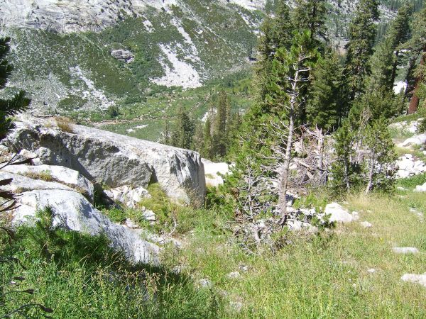
Looking into Deadman Canyon from the canyon wall
I was really happy when I reached a relatively flat and forested area because I knew I was close to the lakes on the west side of the ridge.

Bench and forest close to the lakes
Sure enough, a short time later I was looking down on the lowest of the lakes.

Lowest of the western lakes
I walked around it looking for a campsite but decided I'd go to the next lake up. Soon I found a nice spot and set up camp. After the tiring climb, I decided against climbing up to the higher lakes that day. I could view them the next day from a peak I planned to climb. Arnot's description of the area was right on. The area appears pristine and untouched.
Day 3
The next morning I proceeded up to the pass that connects the lake basins on either side of the divide.
Second lowest of the western lakes from the route to the pass
I passed by a lovely meadow and beautiful tarn as I ascended to the pass.

This beautiful meadow was an unexpected surprise
Fields of flowers slowed my progress as I took photos of them. I probably didn't take the easiest route to the top because I ended up making a few class 3-4 moves toward the top of the pass.

The pass over Glacier Ridge from the west
A lone lump of bear scat reminded me of why the bear went over the mountain.

Bear scat near the ridge top
Whitebark pine krumholtz

Whitebark pine krumholtz on the pass
and clumps of clubmoss ivesia greeted me at the top.
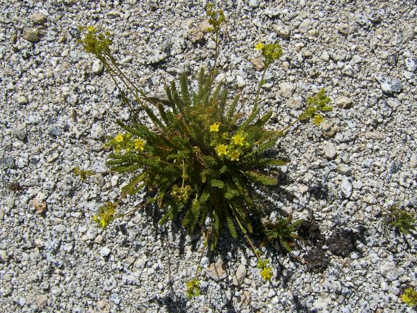
Clubmoss ivesia on the pass
I noticed smoke from a small fire down canyon.
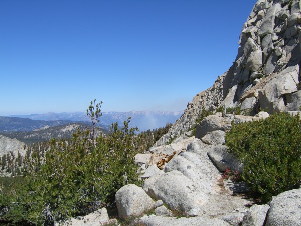
I first noticed smoke from a fire down canyon from here.
A small pile of rocks covered a film canister register at the pass.

I removed several stones from the cairn and discovered the register.
Unfortunately, the route up the peak that would have given me a view of the entire area was not possible from the pass.
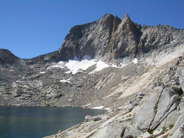
This is the uppermost of the eastern lakes with Peak 12,240 above.
If I had looked at the photo in Arnot's report carefully, I would have recognized that my planned route from the pass was too difficult for me. Instead, I would have climbed up to the higher lakes on the west side and had better access to the summit from there. Five days for this trip isn't really enough time. Six or seven would be better in order to really enjoy all the area has to offer. After all, unless you are Phil Arnot, what are the chances that you will revisit the area? (His is the only name that appears in the register more than once.) The lakes on the east side were lovely. The uppermost was large and tranquil, resting below Peak 12,240. The middle was an intense blue

The middle eastern lake with the Great Western Divide in the background
and Josephine Lake looked lovely as I hiked down to my camp on its shore.

Josephine Lake
I passed by ancient foxtail pines and saw many lovely flowers.

Dead and alive foxtail pines dominate the sparse forest of the upper ridge.
A couple of small tarns held tadpoles of some probably endangered frog species.

Tadpoles thriving in one of the tarns between the middle lake and Josephine Lake
Finally, I found the same camp I used in 1994. There were few signs of wear. The fireplace which I saw in '94 had almost disappeared. Small trout were visible in the crystal clear waters of Josephine Lake.

It was a little too choppy to see trout in the early afternoon. Later the wind died down and they were easily visible.
I arrived at the lake with time on my hands. I did laundry and did a little scouting of the route down into Cloud Canyon. The basin became hazy as smoke from a fire down Roaring River drifted up to higher elevations.
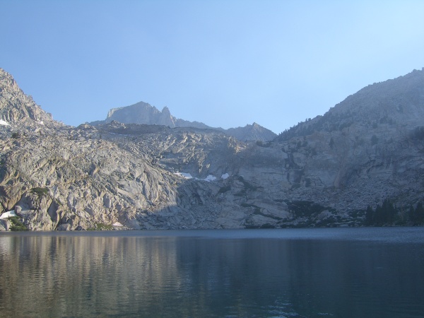
Smoke worked its way up Deadman Canyon and over the ridge from the west.
Day 4
The next morning, the skies were sparkling again as the fire had slept over night.
Skies were clear again the next morning.
I was excited about the descent into Cloud Canyon. Having done it once before, I felt confident it would be fairly easy despite Arnot's claims that it was more difficult than the route on the Deadman Canyon side. Was I wrong! I went too far north and encountered impassable granite cliffs. After some reclimbing and moving farther south, I encountered another route down a drainage that looked promising at first but that I decided was probably too steep. Again, I reclimbed the slope and moved south, only to find nothing but granite cliffs to the south.

I took off my pack and hiked down the outcrop below, only to find a cliff.
Where was the route that I had used 12 years before? It seemed so easy back then. I was just about out of water and thought about dying of thirst. In retrospect, that was an irrational thought because I had plenty of energy to retrace my steps to Josephine Lake. However, I was framing my assessment in terms of the schedule I had planned. That isn't always a good idea. I returned to the drainage that I had previously decided was too steep. The route I had taken in '94 had been through forest but maybe this would work. I couldn't see a route all the way down but that is true of any route down from Josephine. The way got steeper and steeper and hidden around a corner lay the rest of the route which might be impassable. My heart sank as I rounded the corner and saw a drop off. How far was it? I edged closer and guessed that the dry waterfall was 15 to 20 feet high. I pulled out my line and lowered my pack down the drop. Without too much effort, I managed to chimney my way down to the pack. Not much farther down was another drop about as far as the first. Again, I lowered my pack and this time managed to find a few hand and footholds to slow my descent to my pack. The narrow ravine was home to two species of flower which are uncommon to rare in my experience. There were probably a dozen patches of explorer's gentian and several of California fuchsia. The presence of the flowers distracted me from the uncomfortable steepness of the passage. Finally, I could see all the way down to the bottom. Unless I took care, I slipped on the water polished rock. Finally, I was off granite and had only a hundred yards of aspens to wade through before breaking onto the flood plain of Cloud Canyon. I breathed a sigh of relief when I thrashed past the last aspen. In no time I had my shoes off, my water sandals on and I was drinking cup after cup of ice cold water from the middle of the stream as I soaked my hot feet. It was a relief to be down where I could enjoy the pleasures of trail for the remainder of the trip. As I was taking a long lunch break next to the creek, another hiker walked up, Bryan from San Diego. As we enjoyed our conversation, occasionally, I glanced at the canyon wall and wondered how I had got down. After I returned home, I checked my photos of the wall that I descended. They were taken from across the canyon on Cunningham Creek in 1994. After looking at the old photos, I still have no idea how it is possible to ascend or descend the route. The remainder of the trip was fairly routine. I knew I would never make it past Roaring River Ranger Station. I was just too tired after the difficult descent from Josephine Lake. I was surprised to see several people at the campground that I had met on previous hikes. It is definitely a small world. It was good to know that the trail was not blocked by the fire in a couple of different directions, so I slept well with that knowledge.
Day 5
I was up early the next morning and after a long day of hiking was back at my starting point.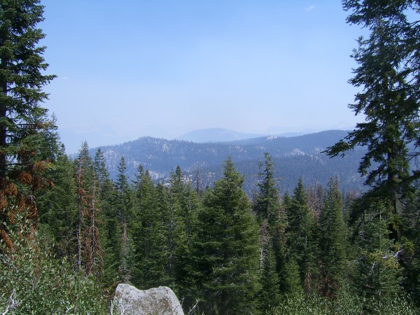
Compare this to the first photo. This was taken from the same place but smoke obscures
the distant view in this one.
Views on the way back were hazy as smoke crept up Sugarloaf Creek, past Comanche Meadow and even higher. A number of icy creeks provided refreshment along the hot, sandy trail. It was a trip to remember.

