Day 1
Unfortunately, I did not get a very early start because of the talkative ranger at the trailhead. In addition, I was delayed when I met George Durkee, the Charlotte Lake ranger and we talked for almost an hour. By the time I got to East Lake it was around 5:00 o'clock and I did not feel like going any farther.
Mt Brewer from East Lake
The area near the bear box at the north end of the lake was crowded but the campers there were gracious enough to invite me to stay. I found the best camp spot on the east side of the lake occupied by the visitor's center trailhead ranger and her boy friend.
Day 2
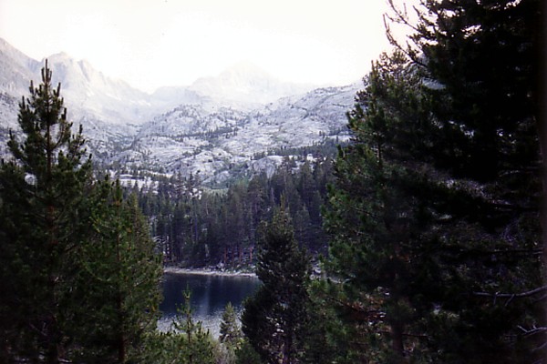
The next morning I was ready to roll at a little after 7:00. The trail to Lake Reflection was much poorer than I had remembered. It was a beautiful, cloudless day, however, and the path was not difficult to find. I wished I had been able to make it to the scenic lake below Lucy's Foot Pass the day before. There were several fine camp spots near the lake and plenty of fish in the lake waiting to be caught for dinner. Lucy's Foot Pass looked very intimidating from that vantage point.
Lucy's Foot Pass from the north
I was glad I had decided to cross over Harrison Pass instead. It took longer to make my way up the canyon than I thought it would. I didn't make it to the top of Harrison until after one o'clock. Two hikers came down the last stretch as I was beginning to go up.
The last stretch to the top of the pass was not easy. Like many passes, Harrison Pass is on a fracture/fault zone.

Harrison Pass from the north
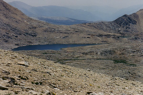
Slickensides and crumbling rock made for slow going to the top. There are shows of copper mineralization in the fractures. I found a nice walking stick with a leather thong through one end of it and I didn't have to wonder why the person who dropped it had not bothered to retrieve it. It was a relief to get to the top of the pass. I spent about an hour taking photos and looking for other routes in the general area that might have been a little easier, but it appears that I found the easiest route. The outline of Lake South America, my destination for the day, could be made out to the southeast.

Lake South America from Harrison Pass
The trip to the lake was fairly straightforward. I had become dehydrated and so I took an extra long water stop at the first creek I encountered. I wasn't prepared for the bleak scenery of the area. As I got closer to Lake South America, I could tell that I would not be by myself. There was a lone fisherman working his spinning rig. I wasn't sure I wanted the company, but what choice did I have? I walked over to meet him when it looked like a meeting could not be avoided. It turned out to be a great experience. The fellow was named Eugene and I would guess that he is in his sixties. Eugene plied me with fish stories for the next hour or so. He even told me the best fishing spots in the Sierra Nevada Range. Later, I wrote down the names of a few of them. Several of them were already on my list of great fishing lakes, so I was grateful for his advice.
As soon as Eugene was finished with his stories, I put together my fishing gear, for I was primed by all the fish talk. The wind started blowing and it began to cloud up and look like rain. The storm had come out of nowhere and soon it was raining off and on but not enough to keep anyone from fishing. I was hoping the stormy weather might inspire the fish to bite as it sometimes does, but I had little luck. Eventually, I caught a small golden but I released him after having no more luck. The peaks of the Great Western Divide, especially Table Mountain and Milestone Peak, could be made out through the thin haze to the southwest.

The peaks of the Great Western Divide from Lake South America
Soon, the storm blew through and Eugene left me with the whole lake to myself. He wanted to cook his fish over a campfire so he headed to the Tyndall Creek Ranger Station area.
Day 3
Having a marathon day ahead of me, I set the alarm and was on the trail before 5:30. The dawn's early light bathed the mountains with a golden glow. The early morning chill made moving at a fast pace comfortable. I followed the trail south toward Tyndall Creek for a while then left it and contoured east then north in order to cut off a couple of miles. I scared a snowshoe rabbit just before I rejoined trail. I met no one on the way up to Forester Pass. There were a couple of tents at a lake east of the John Muir Trail, but no one was up yet. By 8:15, I had reached the top of Forester Pass. Wildflowers by the trail were in full bloom.
Polemonium on Forester Pass
I descended to tree line before ten and briefly explored the well developed campsites among the pines on Bubbs Creek. There were surprisingly few people on the trail. I made it back to Cedar Grove at 6:10 that evening.
