Day 1
I looked forward to using the Florence Lake Ferry so I could compare it to the hike around the lake.
Florence Lake and the ferry dock.
The ferry ride was definitely a positive experience. Soon I was headed up the canyon of the San Joaquin River passing through lush meadows.

Meadows of the San Joaquin River canyon.
After crossing the Piute Creek bridge, the canyon narrowed and the scenery became more interesting.

San Joaquin River between Piute Creek and the forks.
Later in the afternoon, I crossed a bridge over the San Joaquin and decided to look for a camp spot. There were many in the area, so I set up camp and enjoyed the several hours of daylight that remained.
Day 2
The next day, I continued up the canyon to where the river forks, and climbed the switch backs into Evolution Canyon. Ranger George Durkee and his wife were at their cabin, so I stopped to chat and ask directions to the McGee Lakes turnoff. At the upper end of Colby Meadow, I crossed Evolution Creek and soon found the use trail that leads into McGee Canyon. It began clouding up as the trail flattened out into the canyon.
McGee Canyon, Mt McGee and Peter Peak.
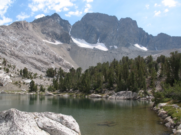
At the first lake, I stopped to photograph it with Mount McGee in the background.

First McGee lake with Mt McGee in the background
Clouds continued to build so I started looking for a flat spot to pitch my tent. Soon I found one next to the small tarn south of Lake 10,816.

I made camp next to this beautiful tarn
I took a nap while it sprinkled. That evening I explored the area above Lake 10,816 and took a few photos of distant peaks bathed in alpenglow.

View toward Evolution Peaks
Day 3
The skies were much less threatening the next morning as I headed up toward McGee Lakes Pass that leads to Sapphire Lake. At the pass I looked back toward the lakes then descended to the John Muir Trail.
McGee Lakes from McGee Lakes Pass
Looking up toward the pass it seemed that no one on the JMT would guess that there was a fairly easy way into another world a little more than a tenth of a mile and 500 vertical feet above.

McGee Lakes Pass from the John Muir Trail
Soon after I got on the trail, I noticed a flower I had seen for the first time when I crossed Evolution Creek toward McGee Canyon. This little gentian also was common above Lake 10,821. It seemed miraculous that it had survived all the traffic on the JMT that passed just an inch away.

Alpine gentian, Gentiana newberryi, an inch away from the John Muir Trail
The JMT was busy with the usual number of through hikers and loopers which was a little bit of a shock since I hadn't seen a soul since I left it the day before. Clouds started building as I passed Evolution Lake.

Upper Evolution Lake from the John Muir Trail
Soon I was back at the crossing to McGee Canyon.

Crossing to McGee Canyon in upper Colby Meadow with The Hermit in the background
I continued through Evolution Valley to its lower end where I found a large camp just above the creek crossing.
Day 4
I began my return by crossing the creek and descending by a number of beautiful cascades.
Cascades on Evolution Creek above the fork
The return to Florence Lake was hot but uneventful.
