It's not easy finding a hiking destination in early July of a heavy snow year. As I pored over maps, I decided it would be best to return to one of my favorite areas, the John Muir Wilderness west of the LeConte Divide. I found an area I had never visited, the Red Rock Basin which is located west of the Red Mountain Basin, one of my favorite haunts. Red Rock Basin; I envisioned towering, red rock formations which would contrast beautifully with the brilliant white of the surrounding snow.
I knew that Beans, my trusty bear hound would be eager to accompany me. She has come on several previous trips and proved to be a tireless hiker and pleasant companion.

Beans, full name Bronwyn Ulani Gunda, is a fortyish (dog years), female Yorkshire Terrier. Through the years, she has managed to maintain her youthful figure. She still weighs six pounds as she did as a youngster. Beans and her dog friends Dillan (also her brother), Cuddles, and Rosie get regular exercise during morning walks on ditch banks near their home in Fresno. Although she loves to bark while at home, she has never been known to do so in the wilderness. She eats dried dog food unless she is hiking when she prefers Cheddar cheese, beef sticks, and chocolate sandwich cookies in that order.
Day 1
We got an early start thanks to having picked up a wilderness permit the day before at the Forest Service offices in Clovis. Beans was a little nervous during the car ride up. It had been a year since her last trip to the mountains. There were few cars in the Maxson Trailhead parking lot, but, after all, it was a Thursday.
The familiar trail led us to the Hobler Lake turnoff which I had not taken for more than 30 years. My memories of Hobler Lake were dim and I was pleasantly surprised at how lovely it is.

Hobler Lake
After a short midmorning snack at the lake, we continued toward Burnt Corral Meadow and the place where we would leave the trail and begin our cross country journey to Red Rock Basin. Soon, I intercepted a trail that had fresh foot prints and hoof prints. I wasn't surprised to find it and I hoped it would make my journey easier. My destination for the day was a small, unnamed lake less than a mile northeast of where I left the trail. Soon the lake came into view a few hundred feet down slope from the trail.

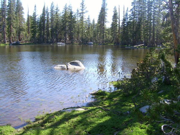
This unnamed lake was where I stayed the first night.
As soon as I arrived at the shore, I picked the most likely camp spot from a distance. It was a few hundred feet east, but I decided to circumnavigate the lake just in case there was a better site elsewhere. I reached a particularly swampy part of the lake on its east end when I noticed that my arms and legs were covered with mosquitoes. As I applied insect repellant to exposed skin, I managed to squish several dozen of the pesky critters.
I arrived at the spot I had picked from a distance and, sure enough, it was the best site. There was a nice flat spot for the tent, a fire ring, and plenty of dead, down wood. My freezer bag noodle meal was soggy but I ate it anyway. A small fire chased away the last of the mosquitoes. We got to bed early and slept in our tent without its rain fly. Beans slept most of the night in my sleeping bag and we slept in and didn't get up until after eight.
Day 2
After a quick breakfast, we returned to the trail and ascended to the divide between Burnt Corral and Post Corral Creeks. The trail became less distinct as Post Corral Creek became steeper and rockier. In places, the ground was covered with tiny wildflowers.

Blue-eyed Mary or Blue Lips, Collinsia torreyi, covered the ground in places.
A nearby cliff had a slight rosy hue, reminding me that we were almost in Red Rock Basin.

These reddish cliffs were some of the few "red" rocks I saw in the Red Rock Basin area.
Finally, we arrived at our destination which was filled with snow.
There were no red rocks visible in the heart of the Red Rocks Basin. Maybe they were all covered by snow.
There wasn't a red rock or even a pink rock in sight. How did this place get its name? After a leisurely lunch, I looked over the map once more and decided to head to a small lake about a mile away. Mount Goddard and Mount Hutton soon came into view.

Mount Goddard on the left and Mount Hutton on the right were visible as I descended toward the lake where I would stay on night two.
I passed what would be the reddest rock I would see during the trip and took a commemorative photo.

These were probably the reddest rocks I saw in the Red Rocks Basin.
A short time later the lake appeared. I circumnavigated it just like I had the previous lake and ended up camping at the spot I had picked from a distance when I first arrived.

This was the largest of many small lakes in this basin.
As I was setting up the tent, I smelled a strong garlic odor and wondered if I had picked the best spot. As I lay down in the tent to test the sleeping surface, the odor disappeared as quickly as it had appeared and Beans and I settled in for a long afternoon nap. A couple of hours later, we got up and as soon as I stepped out of the tent the garlic odor reappeared. I looked down at the ground more carefully and noticed leaves that looked like onions. Nearby tiny flowers were growing up next to the leaves. As I examined them more carefully, they looked like lilies. I dug one up and found a pea sized onion bulb at the base of the flowers. No wonder the place smelled like garlic. I was treading on red Sierra onion, sometimes known as onion garlic.

These tiny onions, Allium obtusum, make a huge stink when stepped on.
After a quick meal of soup, trail mix and tea, Beans and I explored the area a little more and found a trail leading down from our lake. I took a few photos of trees lighted by alpenglow and Beans and I went to bed shortly after sundown so we could be on the trail early the next morning.

The setting sun caused some of the trees to glow.
Day 3
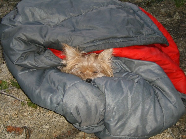
Despite our long afternoon nap the previous day, Beans and I slept through the night until 5:30. Beans did not want to wake up, so I wrapped her in the warm sleeping bag while I had breakfast and packed.

Beans got a little extra sleep in our bag until I packed it away.
We were on the trail a little after six, walking through snow and frosty meadows.

It was chilly during the first leg of the day.
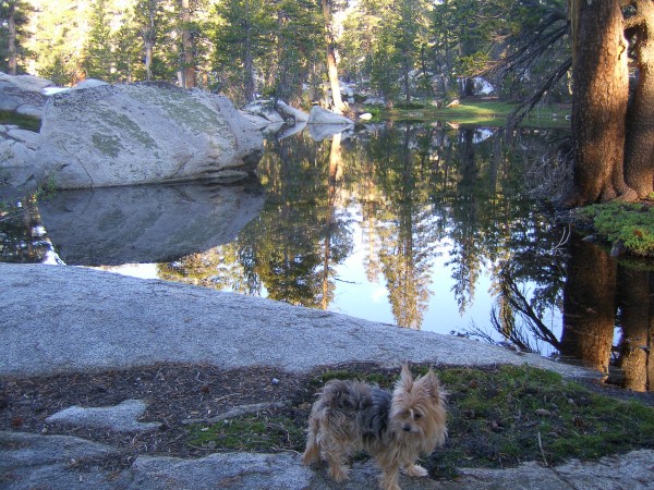
Beans appeared unimpressed as we passed by a small pond reflecting the surrounding beauty.

Beans expression seems to say, "Ho hum, another beautiful reflection."
Eventually we arrived at a large park, complete with a trout-filled, meandering creek and lush meadow.

This huge park separated two steep sections of Post Corral Creek.
We wandered down to the far end which was filled with a lovely lake.

This beautiful lake was at the lower end of the park.
From there we dropped to the confluence of the two branches of the creek, passing many waterfalls

This was one of the first water falls below the park.
and lovely spring flowers on our way.

The phlox was the whitest and freshest I have ever seen.
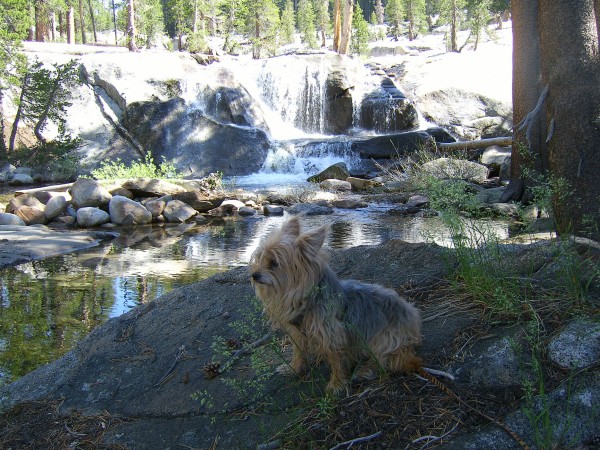
Beans found waterfalls along the way unimpressive, also.

Ho hum, another beautiful waterfall.
We continued hiking south next to Post Corral Creek through forest, thick in places with dead fall. When the creek began to turn east, we crossed it so we could intercept the trail east of Long Meadow. Another creek crossing lay in our way, this time Burnt Corral Creek again, and Beans was beginning to show some fatigue from the long morning of walking. She napped whenever

I don't care if we are crossing the creek right now. I need my sleep.
and wherever she could, including on both sides of Burnt Corral Creek as I changed in and out of water shoes.

Even though I got carried across the creek, it was still hard work
In a few minutes we were back on trail and headed out. Beans seemed to sense that we were going home because she took the lead and picked up the pace. As we got close to the 4WD road her pace became even faster.

The built up trail was very close to the 4WD road and Beans began her final sprint.
Racing along the road toward the parking lot, I pulled out my GPS to check our speed. We were traveling at somewhere between three and four miles an hour. Beans was actually pulling me along a little bit. What a hiker! She took a well deserved nap on the car trip home and was only a little stiff legged when we went out for our morning walk the next day.


