After heavy snows during a previous winter, often it's not easy to know what conditions will be like in the high country in July. I expected to run into a lot of snow at higher elevations. I thought wildflowers might be abundant as well. Little did I know that a tropical storm would trump the winter's effects.
Day 1
The hike started innocently enough with the usual haziness filling the Middle Fork of the Kaweah River canyon.

As well as the usual haze in the Middle Fork canyon, there were some clouds in the sky.
The sky was a little cloudier than usual, but I was sure it would clear up eventually. The trip between Crescent Meadow and Bearpaw Meadow was relatively uneventful. There was the usual complement of hikers; some heading to the resort at Bearpaw and others going to various destinations off the High Sierra Trail. I spent an enjoyable hour with the ranger at Bearpaw discussing wildflowers. On the way to Lone Pine Creek a fearless buck in with a growing rack met me on the trail.

I had quite a conversation with this fearless buck who refused to let me pass by on the trail
Sure enough, by the time evening arrived at Hamilton Lake, the skies were clear, promising several more days in paradise.

Even though the trail crew and an Outward Bound group were at the lake, I got a primo camping spot up above both groups next to my own bear box.
Day 2
As I ascended the trail toward Kaweah Gap, I was amazed by the abundance and variety of wildflowers.

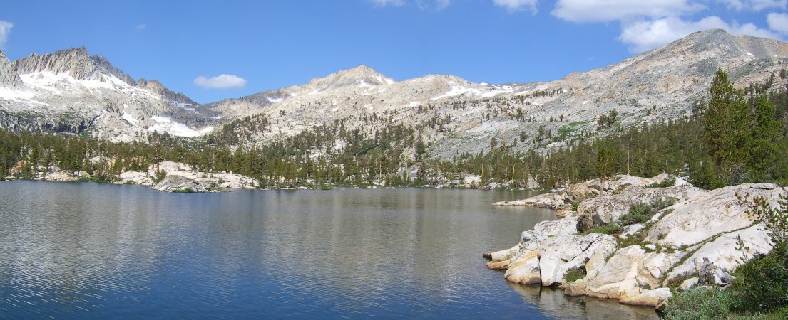
Wildflowers were particularly spectacular between Hamilton Lake and Precipice Lake.
About 40 minutes below Precipice Lake, I ran into my first serious stretch of snow covering the trail.

Snow covered the trail in places even below Precipice Lake.
It wasn't that difficult to get around and soon I was at Precipice Lake which was almost completely covered with snow.

Precipice Lake was almost completely iced over and a ten to twenty foot high cornice covered the outlet area.
A ten to twenty foot high cornice covered the outlet. I felt pretty smug about navigating through so much snow with nary a slip until I got to the end of one patch and fell through to the ice water below.

At the end of a stretch of snow, I plunged through to ice water above my ankles. I was much more careful about where I stepped for the remainder of the trip.
In the process, I managed to soak my shoes and socks, bend my monopod, and damage my camera to the point where it could not be removed from the monopod. It was a cheap lesson on being careful while walking near snow bridges.
Soon, I was standing on Kaweah Gap, but not for long. The skies were becoming increasingly threatening. I squeezed off a couple of photos, one of the Big Arroyo,
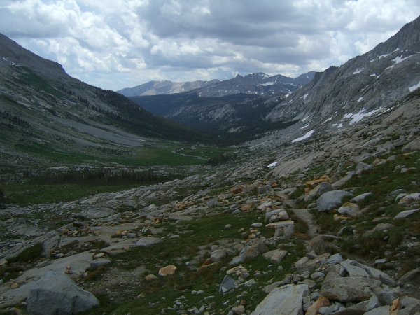
The Big Arroyo was greener than I had ever seen it.
the other of the lowest of the Nine Lakes, before heading down the trail.
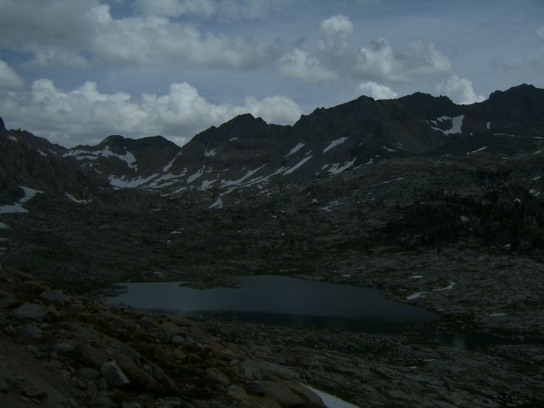
Clouds were building rapidly over the Nine Lake Basin but it hadn't started to rain yet.
Lunch was spent in a grove of foxtail pines a short distance down the arroyo.
This sparse foxtail pine forest provided a scenic lunch stop.
By 3:30 I was at the Big Arroyo Cabin, fresh with a newly attached sign.

The Big Arroyo Cabin had a new sign next to the door urging visitors to help preserve it.
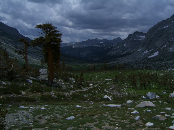
The ascent to Little Five Lakes was much more difficult than I had remembered. At the first ford, I kept my water sandals on and wore them the rest of the way to Little Five. It sprinkled off and on but soon I was enjoying the gorgeous view of the Kaweah Peaks from one of the lakes.

Finally, after a long haul up the hill I was at the heart of the Little Five Lakes. Rain and creek fords slowed me down a bit on the way here.
I set up camp near the bear box, talked to my neighbors a little and had a visit from the ranger who had arrived only a couple of weeks earlier because of the heavy snow accumulation in the area. I returned to the little lake after sunset and took several photos of the peaks as they changed color in the evening light.

After dinner, I returned to the little lake below the trail junction to catch the Kaweah Peaks in evening light.
Day 3
The dawn brought cloudless skies and what promised to be a perfect day in one of the finest areas of Sequoia National Park. I walked around the small lake next to the camp ground taking photos of the superb scenery.
There were dozens of lovely views from the large lake next to the Little Five Lake campground.
Soon, I was on my way to Big Five Lakes and as I arrived at the largest lake, I wondered why I hadn't come here more often. From the largest lake, I could see the unnamed pass I would be crossing in order to return to the Little Five Lakes basin where I would ascend to Blackrock Pass.
Passes to Cyclamen Lake and Little Five Lakes were visible from the west end of the largest of the Big Five Lakes.
The routine ascent to the little pass which I will call 55 Pass since it has no name, passed through a sparse forest of foxtail pines.

The path to 55 Pass follows a forest of foxtail pines, including the old giant in this photo.
Some of the trees were true giants and must be hundreds of years old. I arrived at 55 Pass at noon and took a short lunch break.
From 55 Pass, Blackrock Pass was clearly visible and it looked like I should be over it in an hour or two.
Clouds were building and I wanted to make certain I got over Blackrock Pass before any thunder showers started.
The storm moved in with astonishing speed and about a half hour below Blackrock the rain and lightning stopped me in my tracks. Fortunately, there was a nice rock seat next to the trail, so I stopped for what I hoped would be a short wait. An hour later, the storm had not let up and the first signs of hypothermia made themselves felt. I began looking for a place to bivouac and warm up. Surely the storm would blow over before dusk. I spotted what looked like a fairly flat spot a few hundred feet down the trail. I hustled down there and found that it was not nearly as flat as I had hoped. Not only did it turn out to be the steepest slope on which I have pitched my tent, there was a pointed rock right in the middle of the only place the tent would fit. After a few minutes, I was inside the tent listening to my MP3 player and drifting in and out of sleep as the storm roared outside. Now and then, I would be awakened by the intense clatter of rain on the tent or by dead quiet between squalls.
At a little after six, I stuck my head outside the tent to see a splash of sunshine on Red Spur.

I had high hopes that I would be able to make it over Blackrock Pass when I saw a patch of sunlight brightening Red Spur.
As I prepared to pack and head over the pass, there was a flash of light and an almost simultaneous roar of thunder. I put to rest thoughts of crossing the pass and prepared dinner in the tent.

Still life - Sardines, crackers, and sesame treats on pack.
I awoke around midnight and looked out into clear skies filled with a million stars. The storm had passed!
Day 4
At 5:30, I awoke expecting clear skies and a gorgeous sunrise. I stepped out into the gloom and realized I had only seen a small break in the storm.
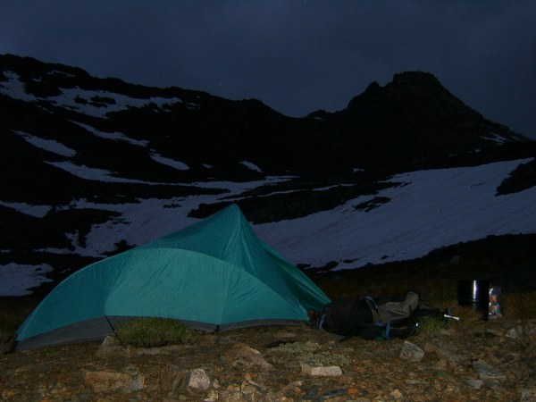
This rocky camp below the pass was pretty good except for the sharp rock poking up in the middle of the floor and the drop off below my feet. At least I didn't get any wetter.
There was a small strip of pink sky to the east but the skies still looked threatening.

The pink stripe on the horizon was sunrise for the day.
It began to sprinkle lightly as I packed my soggy gear. The rain began falling harder and I set a record for breaking camp and getting on the trail, just 30 minutes. In another 30 minutes I was on top of the pass but I didn't linger. I had descended for only a few minutes and felt like I was in a different world. The rain and wind stopped and I was able to take a few photos of Cliff Creek Canyon.

Columbine, Cyclamen, and Spring, the lakes of Cliff Creek, were clearly visible after crossing Blackrock Pass.
Then the storm started to blow west and it began raining some more. I hurried down the snowless side of Blackrock Pass, through the foxtail pine forest and into the canyon. The drizzle came and went but I managed to take a few photos of the scenery including an especially spectacular stand of Bigelow's sneezeweed.

Extensive patches of flowers covered wetter parts of Cliff Creek canyon.
After trudging through the flower filled canyon, I finally arrived at Redwood Meadow at about 2:40 and took a well-deserved rest and lunch stop.

The old cabin at Redwood Meadow is still in good shape and the chair on the porch is a comfortable place to take a break.
Coneflowers in the meadow were breathtaking.

Redwood meadow was filled with coneflowers in their prime.
The old steel chair on the cabin porch was a welcome seat and I let my wrinkled feet dry out for an hour or so as I ate a leisurely meal. Refreshed and ready for a few more hours of hiking, I put on my driest socks and headed down the trail to the Middle Fork of the Kaweah River. A little after four, the peaks on the other side of the river came into view and I could see a bridge far below.

There was an excellent view of granite outcrops on the north side of the Kaweah River as well as a peek at the new bridge over Granite Creek.
It turned out to be a brand new bridge over Granite Creek. It looked like no one had crossed it before I got there. For that matter, it looked like no one had crossed after I did, either. I had to put on sandals for a crossing of Eagle Scout Creek and they felt so good I left them on for the rest of the day. Finally, I reached the ford of the Middle Fork.

This is one of the toughest river crossings I have ever made. The water was swift and up to knee high in places.
The water was swift and deep, especially close to the other side, but I managed to slowly make my way through the knee-deep water without getting too wet. There was a lovely campsite next to the river and I had plenty of time to set up camp and hang things out to dry, actually to get less wet, before eating and going to bed.
Day 5
For the first time in what seemed like a long time, I was able to see my shadow in morning light.

Sometimes a shadow can be a welcome sight. It certainly is when everything you own is damp.
The climb to Bearpaw Meadow from the river was steep, but the trail through the forest was well maintained and I arrived at civilization before I knew it. Bearpaw camp wasn't full by any means, but there was one group that had an amazing array of equipment. They were cooking breakfast with all the fixings on a two burner Coleman stove perched on a table. I commented to the cooks on the setup and they replied how it was amazing what one could fit on one's back.
Soon, I was down at the Buck Creek where I took a break and marveled at all of the monkey flowers next to the bridge.

Monkey flowers, both pink and yellow were abundant on the east side of Buck Creek Bridge. Harvest brodiaea lined the trail as it ascended up the west bank.
I talked to a number of hikers, including my favorite trailhead ranger, as I met them or passed them on the trail. The newly washed air allowed clear views of the southern Great Western Divide