After camp was set up and dinner was prepared and eaten, an exceptionally beautiful sunset developed. The pink and golden rays reflected off the pass I would cross the next day on my way to the Bench Valley country to the south.

Pass to East Fork Meadow Brook from Devil's Punchbowl - The fish were jumping and a party on the other side of the lake was having a good time around the camp fire while the granite walls surrounding the Devil's Punchbowl were bathed in alpenglow.
I had come over the pass from the other direction several years earlier so I was not very anxious about the crossing.
The next morning, it took less than an hour and a half to make it to the top of the gentle pass into the valley of the east fork of Meadow Brook.

The untouched valley of the east fork of Meadow Brook has a certain barren charm.
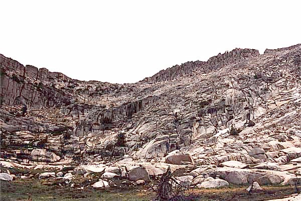
It clouded up like the previous day but it did not rain. The pass from Devil's Punchbowl looked even easier from the south than it had from the north.

The pass from Devil's Punchbowl is straightforward.
The first lake I came to was Crabtree Lake, a beautiful spot with abundant campsites.

Crabtree Lake - I saw several campsites near this lake but the area did not seem to be heavily used.
As I passed near Schoolmarm Lake, a couple of hikers came into view but they never came close enough to talk to.

Schoolmarm Lake - I saw several campsites near this lake but the area did not seem to be heavily used.
I filed this spot away in my memory as a place to spend more time in the future.
Use trails lead from Crabtree lake south to the numerous other lakes in Bench Valley. By lunch time, I had made Guest Lake which is at the foot of the cross country pass into Blackcap Basin. The pass looked intimidating but turned out to be easy as usual.
Pass from Bench Valley to Blackcap Basin - The pass is easier than it looks from here.
Before long, I was looking down on Guest Lake which was now far below.

Guest Lake - There is a pretty nice view to the north and west from the pass above Guest Lake.
Building thunder clouds kept me from climbing nearby Blackcap Mountain. Views in all directions were pleasant but they were especially spectacular towards Blackcap Basin. Dark Mt Goddard loomed over the divide to the east

Mount Goddard - Just east of the LeConte Divide is dark Mount Goddard, the dominant peak of the area.
and Finger Peak was visible to the south.

Finger Peak - To the south lies Finger Peak and the Blackcap Basin.
Picking a route across the basin was a little more challenging than expected. Finally, at a little after five o'clock, I arrived at a lovely campsite on Pearl Lake with views of nearby Finger Peak.

Pearl Lake - From my campsite on Pearl Lake I had a great view of Finger Peak.
The last day was spent on an uneventful marathon return from Blackcap Basin to the Maxon trailhead. Three days of gray skies, that's what the photos show. The clouds have faded from my memory. Three days of glorious scenery and almost total solitude, a fine adventure along the western slope of the LeConte and White Divides, that's what I remember.